Have questions? We're here.
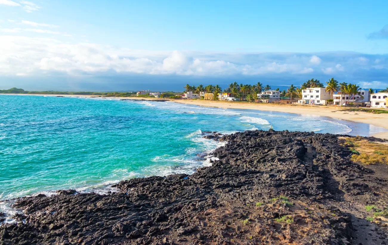
Beach on Isabela island

Galapagos Evolution Circumnavigation

Example 15 Day Cruise aboard Evolution
Talk with an expert
Build your ideal Galapagos trip. Call 1.406.541.2677
Start Planning My Trip
Enjoy an extensive adventure into the unique world of the Galapagos on this incredible journey. This 15-day voyage offers the traveler an opportunity to really become immersed in the unique splendor these islands. Roam across island trails, explore peaceful lagoons, swim and snorkel in crystalline waters, bask in the sun on white sand beaches, soak in extraordinary volcanic vistas, and get up close and personal with fascinating wildlife throughout your Galapagos adventure.
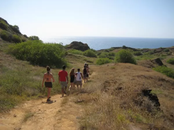
Hiking at Punta Pitt, San CristobalSnorkeling with a sea lion in the warm waters of the GalapagosPhotographing a Masked Booby in the GalapagosA pair of friendly sea lionsBeach on Isabela island
Highlights
  • Hike up Prince Phillip's Steps to see wildlife
  • Journey to Chinese Hat, a cone shaped island
  • Spend time in Black Turtle Cove, a mangrove estuary
  • View new and old tortoises at the Charles Darwin Research Station
Activity Level: Relaxed
Involves minimal physical effort and is typically associated with leisurely activities. Activities are low-intensity or last less than a few hours each day.
0

Full Itinerary

Expand All

Day 1: Baltra | Embark | Santa Cruz

You’ll need to rise early this morning to catch your flight to the Galapagos. All flights to the Galapagos originate in Quito and stop briefly in the port city of Guayaquil to take on passengers before heading on to the islands. For this itinerary, you will be landing on the island of Baltra. After passing through the Galapagos National Park inspection your National Park Guide will be there to greet you, holding a sign with the name of your yacht. Your guide will accompany you on the short bus ride to the waterfront. During WWII the island of Baltra was a US Air Force base and one can still see the remnants of the old foundations left behind from that era. Transfer via panga (launch) to the waiting Evolution. The crew will see that your luggage is transferred to your cabin.

At the dock, board a dinghy (panga) to make the short crossing to Evolution. You only need to bring your carry-on luggage on the panga as the crew will transfer your luggage to your cabin. You’ll have time to settle into your new home for the week before assembling to review safety procedures and coming events with your Galapagos National Park Guide. While this is taking place the Evolution will start her engines and set off into the archipelago.

Type of Landing: N/A
Other Activities: Panga Ride

Bahia Borrero is an incredible mangrove inlet home to an amazing amount of wildlife that will be experienced in a dinghy ride. It is a gorgeous white-sand beach with turquoise waters and is home to a large number of sea turtles, reef sharks, birds, rays, and tropical fish. Daphne Minor, which can be seen at a distance, a tuff cone (giant pile of compressed volcanic ash shaped like a cone), sits off the north coast of Santa Cruz Island, west of Baltra Island and North Seymour Island. This island has (natural) historic importance as a result of the husband-wife biology team of Peter and Rosemary Grant conducting a 20-year field study into the behavior and life cycles of finches as relates to Darwin’s theory of natural selection. Their work is chronicled in the Pulitzer Prize-winning book The Beak of the Finch. As the sun sets on your first day in the Enchanted Archipelago, you’ll toast to the voyage ahead with a welcome cocktail.

Type of Landing: N/A

Day 2: Punta Vicente Roca | Punta Espinoza

Located at the ‘mouth’ of the head of the sea horse, which forms the northern part of the Isabela is Punta Vicente Roca. Here the remnants of an ancient volcano form two turquoise coves with a bay well protected from the ocean swells. The spot is a popular anchorage from which to take panga rides along the cliff where a partially sunken cave beckons explorers. Masked and blue-footed boobies sit perched along the point and the sheer cliffs, while flightless cormorants inhabit the shoreline. The upwelling of coldwater currents in combination with the protection of the coves makes Punta Vicente Roca one of the archipelago’s most sought-after dive spots. One cove is only accessible from the sea by way of an underwater passage. The passage opens to the calm waters of the hidden cove where sea lions laze on the beach having traveled along the underwater route. The entire area of Punta Vicente Roca lies on the flank of the 2,600-foot Volcano Ecuador. This is the island’s sixth-largest volcano. Half of Volcano Ecuador slid into the ocean leaving a spectacular cutaway view of its caldera. The site offers deep water snorkeling where sea lions turtles, spotted eagle rays and even manta rays are the attraction. After your visit here, set off south and west across the Bolivar channel. Keep your eyes open in this best place in the islands for spotting whales.

Type of Landing: Wet
Level of Walk: Easy
Other Activities: Snorkeling, Panga Ride

Fernandina is the youngest and westernmost island in the Galapagos. It sits across the Bolivar Channel opposite Isabela. The destination is Punta Espinoza, a narrow spit of land in the northeastern corner of the island, where a number of unique Galapagos species can be seen in close proximity. As the panga driver skillfully navigates the reef, Galapagos penguins show off by throwing themselves from the rocks into the water. Red and turquoise-blue zayapas crabs disperse across the lava shoreline, while blue and lava herons forage through the mangrove roots. The landing is a dry one, set in a quiet inlet beneath the branches of a small mangrove forest. A short walk through the vegetation leads to a large colony of marine iguanas—a schoolyard of Godzilla’s children—resting atop one another in friendly heaps along the rocky shoreline, spitting water to clear their bodies of salt. Nearby, sea lions frolic in a sheltered lagoon.

Dominating this landscape from high overhead looms the summit of La Cumbre, 1,495 meters (4,858 feet), one of the most active volcanoes in the world. Farther down this stretch of shore, the world’s only species of flightless cormorants have established a colony near an inviting inlet frequented by sea turtles. Because these birds evolved without land predators—it was easier to feed on the squid, octopus, eel, and fish found in the ocean—the cormorants progressively took to the sea. They developed heavier, more powerful legs and feet for kicking, serpent-like necks, and fur-like plumage. Their wings are now mere vestiges. Back toward the landing and farther inland, the island’s black lava flows become more evident, forming a quiet, inner mangrove lagoon where you will spot rays and sea turtles gliding just below the surface. Galapagos hawks survey the entire scene from overhead.

Type of Landing: Dry
Level of Walk: Easy
Other Activities: Nature Hikes 

Day 3: Urbina Bay | Tagus Cove

Isabela is the largest island in the archipelago, accounting for half of the total landmass of the Galapagos at 4,588 square kilometers. Though arrow 
in places, the island runs 132 km from north to south or 82 miles. Isabela is formed from six shield volcanoes that merged into a single landmass. It is also home to the highest point in the Galapagos, Wolf Volcano at 1,707 meters (5,547 feet), and calderas of up to 20 kilometers (12½ miles) across. Urbina Bay is directly west of Isabela’s Volcano Alcedo, make an easy, wet landing (a hop into a few inches of water) onto a gently sloping beach. In 1954, a Disney film crew caught sight of this gleaming white strip and went to investigate. To their astonishment, three miles (5 km) of the marine reef had been uplifted by as much as 13 feet (4 meters) prior to their arrival. They discovered schools of stranded fish and other creatures in newly formed tidal pools along with the skeletons of sea turtles and sharks unable to make it to the ocean as a result of the uplift event. Alcedo erupted a few weeks later.

Now visitors can walk amongst the boulder-sized dried coral heads, mollusks, and other organisms that once formed the ocean floor. A highlight of this excursion is the giant land iguanas, whose vivid and gaudy yellow skin suggests that dinosaurs may have been very colorful indeed. Giant tortoises inhabit this coastal plain during the wet season, before migrating to the highlands when it turns dry. The landing beach provides a nesting site for sea turtles and will also provide you with opportunities to snorkel amongst marine creatures, or just relax on shore. Here you must take care not to step on the sea turtle nests dug carefully into the sand. For those looking for snorkeling from a beach this is the place, with tropical fish hiding amongst the rocks to the north side of the bay.

Type of Landing: Wet
Level of Walk: Moderate
Other Activities: Nature Hikes 

Head north along the western coast of Isabela Island, to Tagus Cove, named for a British warship that moored here in 1814. Historically the cove was used as an anchorage for pirates and whalers. One can still find the names of their ships carved into the rock above the landing, a practice now prohibited. The cove’s quiet waters make for an ideal panga ride beneath its sheltered cliffs, where blue-footed boobies, brown noddies, pelicans, and noddy terns make their nests, and flightless cormorants and penguins inhabit the lava ledges. From the landing, a wooden stairway rises to the trail entrance for a view of Darwin Lake; a perfectly round saltwater crater, barely separated from the ocean but above sea level! From the air one can see that both Tagus Cove and Darwin Lake are formed from one, partially flooded, tuff cone on the eastern edge of the giant Darwin volcano. The cove is formed by a breached and flooded section of the crater with Darwin Lake forming the very center of the same cone. The trail continues around the lake through a dry vegetation zone and then climbs inland to a promontory formed by spatter cones. The site provides spectacular views back toward anchorage, as well as to Darwin Volcano and Wolf Volcano to the north. As you set sail north to navigate out of the channel back towards the central islands keep your eyes peeled as this is one of the best places in the islands to spot whales and dolphins that feed in these productive waters created by the upwelling of the Cromwell Current. And while you watch you can enjoy a happy hour at the Sky Lounge on the upper rear deck.

Type of Landing: Dry
Level of Walk: Difficult
Other Activities: Nature Hikes, Snorkeling, Panga Rides & Kayaking

Day 4: Bartolome | Santiago

Bartolomé is famous for Pinnacle Rock, a towering spearheaded obelisk that rises from the ocean’s edge and is the best-known landmark in the Galapagos. It served as a backdrop in the film Master & Commander. Galapagos penguins—the only species of penguin found north of the equator—walk precariously along narrow volcanic ledges at its base. Sea lions snooze on rocky platforms, ready to slide into the water to play with passing snorkelers. Below the surface, shoals of tropical fish dodge in and out of the rocks past urchins, sea stars, and anemones. A perfectly crescent sandy beach lies just to the east of the pinnacle and across a narrow isthmus another beach mirrors this one to the south. Sea turtles use both beaches and another to the west of the Pinnacle as nesting sites and can sometimes be seen wading back out into the shallow water near the shore or resting in the sand recovering from the arduous task of digging nests, laying eggs, and covering them over.

Penguins like to rest atop the nearby rocks by the next landing site, about a quarter mile east along the shore. Here the submerged walls of a tiny volcanic crater give the impression of a large fountain pool. This dry landing—no wet feet!—is the entrance to a 600-meter (2000-foot) pathway complete with stairs and boardwalks leading to Bartolome’s summit. The route is not difficult and presents an open textbook of the islands’ volcanic origins; a site left untouched after its last eruption, where small cones stand in various stages of erosion and lava tubes form bobsled-like runs down from the summit. At the top, you will be rewarded with spectacular views of Santiago Island and Sullivan Bay to the west, and far below, Pinnacle Rock, where the crystal turquoise waters of the bay cradle your yacht. The next landing site is a short distance away to the southeast.

Type of Landing: Dry
Level of Walk: Difficult
Other Activities: Nature Hikes, Snorkeling & Panga Ride

If you created a partnership between well know glass artist Dale Chihuly and mother nature the result would be Sullivan Bay. Back in 1897, the island fired up its own internal kiln giving birth to a field of pahoehoe (“rope-like” in Hawaiian) lava reaching out into the channel toward Bartolome. The results gleam in the sun like a gigantic, obsidian sculpture. It stirs the imagination to envision the once-molten lava lighting up the earth, flowing into the sea, and sending plumes of superheated steam skyrocketing into the air as pockets of gas in the flow exploded when the lava hit the water. The flow gave birth to the new land as it engulfed vegetation, leaving some plants forever etched into the earth. Today the flow stands as a great walkway gallery of abstract shapes resembling braids, curtains, and swirling fans. Brightly colored painted locusts and lava lizards punctuate the black volcanic canvas, as does the occasional finger of lava cactus and spreading carpetweed. Hike south into the flow taking time to admire the Earth’s craftwork as you proceed.

Upon return to the black rocky coast, you may spot Galapagos penguins that dot the shore. Unlike the penguins, which mimic the lava with their color, sally light foot crabs stand out against the black rocks as a reminder of their once molten state. Snorkeling along the edge of the lava flow is very good for swimming with penguins and sea lions. Squadrons of spotted eagle rays pass through the channel, and sea turtles that lay their eggs on nearby Bartolome swim past, while white-tipped reef sharks patrol the bottom.

Type of Landing: Wet
Level of Walk: Moderate
Other Activities: Nature Hikes, Snorkeling

Day 5: Bachas Beach | Rabida

At the north end of Santa Cruz Island is Las Bachas, comprised of two sandy white-coral beaches that are major egg-laying sites for sea turtles. The official story of how Las Bachas got its name comes from the Galapagos National Park. During WWII the US military discarded two barges on the beaches. When the first settlers to the area following the war arrived they mispronounced barges as bachas, resulting in the name. There are other explanations of how the location got its name having to do with indentations left in the sand by both egg-laying sea turtles and their departing hatchlings, but go with the Park’s. Go ashore on the white sandy beach and are greeted by patrolling blue-footed boobies. A brief walk inland takes to a lagoon where pink flamingos are often found along with great blue herons, common stilts, brown noddies, white-cheek pintail ducks, and migratory birds. Snorkeling today is from the beach and you can also enjoy a swim in these waters, which are typically warmer than in other places in the Galapagos.

At the geologic center of the archipelago, Jervis presents an island of a different color with its deep red sandy beach and equally red towering cliffs. Even the starfish are red. The flanks of a sloping volcanic cinder cone rise sharply from the coast and looking up one can see where the vegetation transitions from the arid zone to the wetter Scaleisia zone. A hedgerow of green saltbush frames the beach between the clear teal waters of the Pacific making for one of the more colorful islands. A noisy colony of sea lions inhabits these scarlet shores. This is also the best place in the islands to get close to nesting brown pelicans raising their chicks in precariously positioned nests atop the saltbush. A short trail inland offers observations of land birds including the Galapagos dove, cactus finch and the large ground finch. Hidden behind the narrow strip of green saltbush is a briny lagoon frequented by flamingos. These large pink birds feed for up to 12 hours a day on the pink shrimp larva and water boatman that give them their color. Follow the trail to the left and up from the beach to the top of the rocky peninsula that juts from the island towards the north. As you climb higher you pass through groves of prickly pear cactus, some oddly reminiscent of Mickey Mouse. The top of the overlook reveals excellent views back toward the lagoon and red sea cliffs beyond.

Type of Landing: Wet
Level of Walk: Easy
Other Activities: Nature Hikes & Snorkeling

Rabida also offers a nice kayaking route starting on the eastern side of the peninsula, then around and along it. The route continues west past the beach, then beneath the island’s towering red cliffs. This is a great place to spot sea turtles from your kayak. They sometimes swim right up without noticing you and then dart into the depths once they see you. Make sure you stop kayaking when you reach the red diamond-shaped sign where there is a large rock where both blue-footed and masked boobies like to perch. Beneath the ocean surface, Rabida offers excellent snorkeling along the shore of the little peninsula. The sea turtles you just saw topside are easier to see once you are in the water. Giant schools of stripped salemas have been seen to carpet the deeper sections, attracting Galapagos sharks. Large schools of yellow-tail surgeon fish thread through passages between the rocks. You can look for chances to swim with sea lions and penguins as well and keep your eyes open for marine iguanas grazing the underwater greenery. You’ve also had groups watch orca right off the shore on rare occasions but this pod can also be seen elsewhere as they patrol the islands.

Type of Landing: Dry
Level of Walk: Easy
Other Activities: Nature Hikes, Snorkeling, Panga Rides & Kayaking

Day 6: Pit Craters & Highlands | Charles Darwin Research Station

Santa Cruz, the next stop, is the second-largest island in the Galapagos and something of a hub for the archipelago. Baltra, where one of the archipelago’s two airports is found, is on the far north end of the island. Puerto Ayora, located in the south of this large, round volcanic island is the seaside economic center of the Galapagos, focused on fishing and tourism. The little port town offers restaurants, hotels, souvenir shops, internet cafés, and a place to get your laundry done! This morning, visit Puerto Ayora, home to both the Galapagos National Park Service Headquarters and Charles Darwin Research Station, the center of the great restorative efforts taking place in the park, and a UNESCO World Heritage site. Here, visit the Giant Tortoise Breeding & Rearing Program run by the research station, which began by rescuing the remaining 14 tortoises on the island of Española in 1970. This program has restored the population of animals there to over 1,000 today. You will see many of these animals, with their sweet ET necks and faces; from hatchlings to juveniles to large, distinguished individuals. This is where the famed tortoise, Lonesome George, lived out his last days as the last of his particular race of tortoises.

Type of Landing: Dry
Level of Walk: Easy
Other Activities: Shopping in Puerto Ayora

A highlight of any trip to the archipelago is a visit to the Santa Cruz Highlands, where the sparse, dry coastal vegetation transitions to lush wet fields and forests overgrown with moss and lichens. The afternoon destination is the Wild Tortoise Reserve and get chances to track and view these friendly ancient creatures in their natural setting. This extends to the adjacent pasturelands, where farmers give tortoises safe quarters in exchange for allowing paying visitors to see them. When viewing the tortoise in their natural setting you are literally scratching the surface because there is another world awaiting you beneath the highlands. Lava tubes are formed when the outer surface of a lava flow cools, insulating the interior lava, which continues to flow on leaving a hollow tube as a result. The tubes become covered with earth over time and the result is a perfectly formed underground tunnel courtesy of Mother Nature. A wooden stairway descends to the mouth of the arched entrance to one of these underground passages and continues to the narrow opening that marks its exit. There are lights to show you the way but it’s also a good idea to bring a flashlight.

The terrestrial world of the tortoise and the underworld of the lava tubes meet at Los Gemelos (the twins). These two large sinkhole craters were formed by collapsed lava tubes. The contrast between the marine desert coast and the verdant Lost World look of the highlands is most striking here and you can easily encounter rain even when the sun is shining half an hour away at the coast. Los Gemelos is surrounded by a Scalesia forest. Scalesia is endemic to Galapagos and many endemic and native species call the forest home. This is an excellent place to view some of Darwin’s famous finches along with the elusive and dazzling vermillion flycatcher. Return to Puerto Ayora with time for shopping, visiting an internet café, or simply enjoying this little port town near the edge of the world.

Type of Landing: Dry
Level of Walk: Easy
Other Activities: Nature Hikes

Day 7: Punta Suarez | Gardner Bay

Hood is the southernmost island of the archipelago and is one of the most popular due to the breathtaking variation and a sheer number of fauna that greet visitors along with the well-known Gardner Bay. The giant tortoise was reintroduced to Hood in the 1970s and counts as one of the park’s great success stories. They reside in an off-limits area. The quantity and variety of wildlife at Punta Suarez is remarkable. Sea lions surf the waves beyond the breakwater landing, and tiny pups are known to greet your toes upon arrival. A few steps inland is a colorful variety of marine iguanas in the Galapagos. They bear distinctive red and black markings, some with a flash of turquoise running down their spine. They nap in communal piles or cling to the rocks for warmth. The trail then takes beside the western edge of the island where masked boobies (also known as Nazca boobies) nest along the cliff’s edge. The trail descends to a rocky beach before rising to an open area where you may see a large gathering of nesting blue-foot boobies. Galapagos doves, cactus finch, and mockingbirds forage nearby, unconcerned by human presence. Both lava and swallow-tailed gulls, with their red-ringed eyes, sit atop the cliffs in company with marine iguanas.

The trail continues to the high cliff edge of the southern shore; below, a shelf of black lava reaches out into the surf where a blowhole shoots a periodic geyser of salt water into the air. Further east along the cliff is the Albatross Airport where waved albatross line up to launch their great winged bodies from the cliffs, soaring out over the dramatic shoreline of crashing waves and driven spray. These are the largest birds you will see in the Galapagos with wingspans up to 2.25 m or 7.4 ft. They are the only species of albatross exclusive to the tropics. The trees set back from the cliff are one of only two places in the world where the waved albatross nests. The 12,000 pairs that inhabit Hood Island comprise all but a tiny fraction of the world’s population of this species. Lucky visitors can watch courtship ‘fencing’ done with great yellow beaks. Large, fluffy, perfectly camouflaged chicks adorn nests on the ground nearby. The Albatross lay their eggs from April through June though they can be seen fencing long after that. Eggs take two months to hatch. Hungry chicks can eat up to 2 kg (4.4 lb) a day which keeps their parents busy. By December the chicks are fully grown and ready to set out on their own in January. Pairs mate for life.

Type of Landing: Dry
Level of Walk: Difficult
Other Activities: Nature Hikes

On the northeastern shore of Hood, Gardner Bay offers a magnificent long white sandy beach, where colonies of sea lions laze in the sun, sea turtles swim offshore and inquisitive mockingbirds boldly investigate new arrivals. You will be lured from the powdery white sand into the turquoise water for a swim, but just a little further off-shore the snorkeling by Gardner Island offers peak encounters with playful young sea lions and schools of surprisingly large tropical fish, including yellow-tailed surgeonfish, king angelfish and bumphead parrot fish. The young sea lions like to snack and play along Gardner Island’s sea cliff. They dart up from the depths, playfully show off their skills and then disappear. Sleepy white-tipped reef sharks can also be seen napping on the bottom. 

Type of Landing: Wet
Level of Walk: Easy
Other Activities: Nature Hikes, Snorkeling & Panga Ride

Day 8: Kicker Rock and Interpretation Center | Cerro Brujo

San Cristobal was the first island Darwin visited when he arrived in 1835. He reported encountering a pair of giant tortoises feeding on cactus during that outing. Today the airport of this easternmost island in the chain is increasingly used as the arrival point for flights into and out of the Galapagos. The administrative capital of the province is Puerto Baquerizo Moreno on the southwestern shore. Your guide will give you clear instructions on the rest of the day’s events before you go ashore. Once you arrive in the pot, board a dinghy (panga) to make the short crossing to the dock. In recent years a great deal of effort has gone into sprucing up the waterfront including the building of the new municipal dock. You only need to bring your day pack as the crew will pick up your luggage at your cabin and ensure that it gets to the airport, which is less than a 5-minute drive from the waterfront. One of the most sought-after sites in the Galapagos, Kicker Rock, also known as León Dormido, is the remains of a volcanic cone, eroded by the sea over hundredths of years. It is the eroded cone of an extinct volcano in the shape of a sleeping lion which earned it the name, Leon Dormido. Above the water, the monolithic rock formation towers over 500 feet above the Pacific Ocean and is home to various Blue-Footed Boobies, Frigatebirds, California Sea Lions, and Red-billed Tropicbirds.

In 1998 the Galapagos National Park Visitor Center opened for the benefit of islanders and travelers alike, presenting a comprehensive exhibit of the islands’ natural history, human interaction, ecosystems, flora, and fauna. This is the place where cultural activities take place, including theatre, exhibitions, and workshops. From the Interpretation Center, a short trail arrives at Frigate Bird Hill, where both “magnificent frigates” and “great-frigates” can be seen in the same colony—ideal for learning to distinguish the two bird species. 

The Visitor Center is also the place where cultural activities in San Cristobal Island take place, including theatre, exhibitions, and workshops. From the Interpretation Center, a short trail arrives at Frigate Bird Hill, where both “magnificent-frigates” and “great-frigates” can be seen in the same colony— ideal for learning to distinguish the two bird species. Along with your tour of the visitor center museum, there will be time to stroll the quaint tiny port town, with time to shop for souvenirs as you await the arrival of your new travel companions for a second week full of adventure in the Galapagos. Everyone will meet at the dock and board dinghies (pangas) to make the short crossing back to the Evolution.

Just as you did on arrival a week earlier, you’ll assemble once again on deck with the rest of the newly arrived Guests to review safety procedures and coming events with your Galapagos National Park Guide. While this is taking place the Evolution will start her engines and set out to the next landing site. Heading up the coast from Wreck Bay and Puerto Baquerizo spot Leon Dormido to the north. Also known as Kicker Rock, the spectacular formation rises 152 meters (500 feet) out of the Pacific. It takes the form of a sleeping lion (hence its Spanish name), but from another angle you can see that the rock is split, forming a colossal tablet and, piercing the sea, a great chisel ready for etching.

Type of Landing: Dry
Level of Walk: Easy 
Other Activities: Nature Hikes

Set out along the coast of San Cristobal heading northeast toward landing at Cerro Brujo. This inviting powdery beach beside turquoise waters is a great introduction to the islands offering your first opportunity to go snorkeling with sea turtles, rays, and the archipelago’s playful ‘wolves of the sea’ i.e. sea lions. After walking the trail in search of baby sea lions and boobies beneath the salt bushes have a real treat in store. Change into snorkeling gear for some swimming with sea lions! The sea lions like to dart past, and then swim up to you to blow bubbles at your mask. On occasion, they have been known to leap over, and then dive in front of unsuspecting snorkelers. In short, the sea lions are real show-offs and this is the first place where you will have the opportunity to go snorkeling with them. Following our outing you will discover that the best place to warm up from your dip is in the Evolution’s oversized Jacuzzi. The afternoon comes to a close as head south back to Puerto Baquerizo Moreno. Enjoy your Pacific sunset aboard the Evolution by celebrating happy hour atop her sky lounge where drinks are available daily along with hors d’oeuvres. A little later gather in the main salon for the daily presentation by guide on the next day's activities and visitor sites, before sitting down to dinner. Spend a bit more time in port this evening before setting sail for your next destination to the northwest.

Type of Landing: Wet
Other Activities: Snorkeling, Panga Ride, Kayaking & Nature Hikes
Day 9: South Plaza Island | Punta Carrion | Mosquera Island

South Plazas Island lies just a few hundred meters off the east coast of Santa Cruz Island and is one of the smallest, yet richest islands in the archipelago. Just over 400 feet wide, it was formed by lava upwelling from the bottom of the ocean. The landing is in the channel between North and South Plaza, where the island tilts toward the water. South Plaza is known for its lush and diverse flora. A grove of luminescent green prickly-pear cacti, a ground cover of red sesuvium, the turquoise waters of the channel, and fiery sally lightfoot crabs against the black lava rock combine to create a colorful palate of an island to explore. One of the big attractions here is the friendly yellow land iguanas waiting for lunch to drop from a cactus in the form of a prickly pear. Follow a trail up the tilt of the island to cliffs that look out over the ocean. Swallow-tailed gulls, with red banded eyes, nest atop the overlook where you may spot marine life such as manta rays. South Plaza has a very healthy population of sea lions including a colony of bachelors that sit atop the cliff. They unintentionally polish the surrounding rocks with the oil from their fur. You may see red-billed tropic birds, Nazca (masked), and blue-footed boobies catching rides on the wind currents.

Type of Landing: Dry
Level of Walk: Easy
Other Activities: Nature Hikes

Between the north end of Santa Cruz Island and the Galapagos’s other airport on Baltra Island lays the narrow Itabaca Channel. The channel takes less than 5 minutes to cross by ferry. Punta Carrion juts out from the north of Santa Cruz Island to mark the southeastern entrance to the channel and the snorkeling/dive site that it gives its name. It’s time to step up your snorkeling just a bit with some real rewards. The inviting green-turquoise cove close to shore will beckon you to enter the water. Friendly cousins of the sea lion welcoming committee from yesterday will of course be there to make you feel right at home and introduce you to large schools of yellow-tail surgeon fish interwoven with large parrot fish interlopers. Creole fish and blue striped sea slugs and moray eels inhabit the spaces in the rocks. You can stay in the shallow, protected cove or venture out toward the deeper waters where white-tipped-reef sharks and the occasional hammerhead inhabit the channel and tuna and red-tailed snapper pass through. Ashore you will see blue-footed boobies, brown pelicans; Galapagos herons, and great blue herons.

Located between North Seymour and Baltra is the small island of Mosquera. The island consists of a long narrow stretch of white sand, rocks, and tide pools. Created by geological uplift, the island has a flat look to it rather than the conical shape of the volcanically formed islands. A stroll down the beach offers views of the brown pelicans, boobies and colonies of sea lions that like to laze here. The tiny spit of land has one of the largest populations of sea lions in the Galapagos. Along the rocks and in the tide pools are the now familiar sally lightfoot crabs (red lava crabs). They follow the tide eating the algae and detritus left behind. Ever aware of movement around them, the sally lightfoot is quick to escape from approaching predators, in stark contrast to the unabashed way the crabs climb over the sedentary marine iguanas.

A short distance to the east of Mosquera you will notice a small table-like island and just to the south of this, an island comprised of a single volcanic cone (called a tuff cone). The larger island is known as Daphne Major and the smaller table island is Daphne Minor. Navigating close by the larger of the two islands, Daphne Major. Though Daphne is just a short distance from Baltra, with its airport, the Galapagos National Park restricts visits here. Because her shores are teaming with life, especially birds, cruise past her shores for a look. The island has been of central focus to scientific researchers and featured in The Beak of the Finch, the Pulitzer Prize-winning non-fiction book about the work done by biologists Paul & Rosemary Grant. You will not only see finches, but short-eared owls, masked boobies, and Galapagos martins as you pass along her shores. Your day ends aboard the Evolution’s sky lounge as you raise your glasses to the Pacific sunset. The next landing is just off the southeastern shore of Santiago Island looming to the northeast.

Type of Landing: Wet
Level of Walk: Moderate
Other Activities: Nature Hikes, Snorkeling, & Panga Ride

Day 10: Chinese Hat | James Bay

Tiny Sombrero Chino (Chinese Hat) Island is named for the resemblance its shape has to a traditional Chinese Coolie’s hat. Today’s visitor site is off-limits to larger groups and day boats, making Sombrero Chino, along with Daphne Major, one of the least visited sites in the central islands. The island lies just off the southeastern tip of the large nearby island of Santiago; separated by a narrow channel that makes for very calm, protected waters. The landing site is a tiny crescent-shaped cove with a sandy white beach cradled between black lava rocks and the crystal turquoise waters of the channel. A sea lion colony likes to rest on the warm white sands, while the rockier sections of the coast are alive with fiery-colored sally lightfoot crabs. Marine iguanas sun themselves atop the rocks after foraging for algae in the channel. American oystercatchers stalk the tide pools stabbing at shellfish with their bright orange beaks. A quarter mile (400 meters) trail sets off into the island’s volcanic interior to explore its rock formations, including excellent examples of pahoehoe lava resembling black rock ropes. The area is inhabited by ground-hugging red sesuvim plants and curious lava lizards.

Back at the cove, you will not only have another opportunity to snorkel with sea lions but rockier sections of the coastline are inhabited by Galapagos penguins that dart past unsuspecting snorkelers. You’ll also have a chance to see the penguins during a panga ride. Galapagos penguins are the only species of penguin you’ll find living north of the nearby equator. Paddlers will have the opportunity to kayak here in the areas that are not off-limits (indicated by National Park Signs).

Type of Landing: Wet
Level of Walk: Easy
Other Activities: Nature Hikes, Snorkeling & Panga Ride 

In the early afternoon, set out west, making your way along the length of Santiago’s dramatic southern coastline before turning north up her western shore as you make for James Bay (Puerto Egas). This location offers access to three unique sites. One landing is on a black beach with intriguing eroded rock formations inland. A trail crosses the dry interior eastward and rises to the rim of an extinct volcanic crater; cracks within it allow seawater to seep in, which then dries to form salt deposits that have been mined in the past. Darwin describes his visit to South James Bay in Voyage of the Beagle.

Another path leads south, where hikers are treated to a series of crystalclear grottos formed of broken lava tubes. These are home to sea lions and tropical fish. This is the best place on the islands to see fur sea lions as they laze on the rocks by the grottos. Further to the north, another landing and path lead to a series of inland lagoons, home to flamingos. Birders coming to James Bay will have the opportunity to spot vermillion flycatchers, Galapagos hawks, and the tool-wielding woodpecker finch. Puerto Egas is a good spot for taking pictures—the light for photography is perfect at sunset which lights up the distinct rock layers that form the shore. The lava and the black sand seem to catch fire and the animals acquire a surreal quality. The marine iguanas that inhabit the area resemble Samurai warriors and can easily be seen grazing on seaweed in the more shallow pools near the grottos.

Type of Landing: Wet
Level of Walk: Easy
Other Activities: Nature Hikes

Day 11: Darwin Bay Beach | Prince Phillip’s Steps

Tower Island could serve as a film set for a remote secret submarine base. The southwestern part of the island is an ocean-filled caldera ringed by the outer edges of a sizeable and mostly submerged volcano. The island sits to the northwest, slightly removed from the Galapagos archipelago. It is also known as Bird Island, a name it lives up to in a spectacular way. Landing on the white coral sands of Darwin Bay and walking up the beach, you will be surrounded by the bustling activity of great frigate birds. Puffball chicks and their proud papas—who sport bulging scarlet throat-sacks—crowd the surrounding branches, while yellow-crowned herons and lava herons feed by the shore. Farther along you will discover a stunning series of sheltered pools set into a rocky outcrop. Watch your step for marine iguanas, lava lizards, and Galapagos doves that blend with the trail. The trail beside the pools leads up to a cliff overlooking the ocean-filled caldera, where pairs of swallow-tailed gulls, the only nocturnal gulls in the world, can be seen nesting at the cliff’s edge. Lava gulls and pintail ducks ride the sea breezes nearby. A brief panga ride brings us to the base of those same cliffs to reveal the full variety of bird species sheltering in the ledges and crevices created by the weathered basalt. Among them, red–billed tropic birds enter and leave their nests trailing exotic kite-like tails. This is also an intriguing place to go deep-water snorkeling. Tower offers two very different snorkeling experiences along the cliffs that form the inner part of the caldera.

The center of the caldera is very deep and attracts hammerheads and large manta rays which sometimes patrol the western edge of the caldera that is more open to the sea. You can snorkel here gazing down into the depths where you just may spot these large animals if you are fortunate. But don’t worry, if you don’t really want to see them there is an equally amazing and far more sheltered snorkeling experience for you across the bay.

Type of Landing: Wet
Level of Walk: Moderate
Other Activities: Nature Hikes, Snorkeling, Panga Rides & Kayaking

Across the bay is Prince Phillip’s Steps, named for a visit by the British Monarch in 1964. The shoreline here falls off less sharply into the depths and is far more protected. The first thing you will notice when snorkeling here is very large tropical fish. These are warm-water fish feeding off cold-water nutrients. You’ll find the full assortment here including oversize parrot, unicorn, angel, and hogfish along with schools of perch, surgeon fish, and various types of butterfly fish. Hiding in and around the rocky shoreline that drops off into the caldera you will also see a rainbow assortment of wrasse, basslet, anthias, and tang. This is the place to bring your underwater tropical fish identification chart. There are some special treats to be found here including occasional visits by fur sea lions. This area of the bay is also excellent for some kayaking in the calm waters close to the shore to observe nesting birds.

Prince Phillip’s actual steps are a 25-meter (81-foot) stairway leading up to a narrow stretch of land that opens out onto the plateau surrounding Darwin Bay. It extends to form the north side of the island. Red-footed boobies wrap their webbed feet around branches to precariously perch in the bushes, and, in contrast, their masked-booby cousins dot the surface of the scrublands beyond. Crossing through the sparse vegetation, you will come to a broad lava field that extends toward the sea—this forms the north shore of the island. Storm petrels flutter out over the ocean in swarms, then return to nest in the cracks and tunnels of the lava field but not without hazard. Short-eared owls lay in camouflaged wait and make their living feeding off the returning petrels. Remember to watch Tower’s inner bay at sunset as you might spot a giant manta ray.

Type of Landing: Dry
Level of Walk: Moderate
Other Activities: Nature Hikes & Panga Ride

Day 12: North Seymour | Santa Fe

North Seymour Island was lifted from the ocean floor by a seismic event, and its origins as a seabed give the island its low, flat profile. Cliffs only a few meters high form much of the shoreline, where swallow-tailed gulls sit perched in ledges. A tiny forest of silver-grey Palo Santo trees stands just above the landing, usually without leaves, waiting for the rain to bring them into bloom. This island is teeming with life! You might have to give way to a passing sea lion or marine iguana. Blue-footed boobies nest on either side of the trail where mating pairs perform their courtship dance. You are likely to see fluffy white chicks peeking out from beneath their protective mothers. The trail follows the eastern shore along the beach. You may be fortunate to witness flocks of brown pelicans and blue-footed boobies hunting schools of fish. The boobies, which look so comical on land, are ideally adapted as dive bombers and easily pierce the water, zeroing in on their targeted prey. Frigate birds with wingspans of up to 5 feet soar overhead and all around. They were named for the way that the trim of their wings in flight are reminiscent of the square-rigged sailing warship. Not coincidentally frigate birds are also called Man O’ Warbirds and they live up to that name in a literal way when they target boobies, pelicans, and other birds to steal their catch. Because the frigates are pelagic, they lack the ability to take off from the water, so they do better at snatching fish from the surface or simply stealing them. They also target marine iguanas and young baby sea turtles.

The trail turns east and inland to reveal the nesting stronghold of the frigates. Here you can see males with large, bright red, inflated throat sacks known as gular pouches, all done in an effort to attract females. Your guide will point out the difference between the Magnificent, or Man O’ War frigates and their Great frigate bird cousins. Large puff-ball frigate bird chicks inhabit nests, waiting for their parents to return with a meal. Even at this young age they possess long hooked beaks and act defiant when they feel threatened. You will also get a closer look at the feathers of the proud parents and notice their iridescent quality and deep green tinge.

Another inhabitant along the trail is the yellow land iguana. The species was originally introduced to North Seymour in 1932 by Captain Alan Hancock and his crew from Baltra with the aim of rescuing the creatures from the poor conditions left by goats and other feral animals. The iguanas colonized the island without a problem. The original colony disappeared from Baltra when it became a US military base in WWII. In 1980 Charles Darwin Station began a breeding program using some of the animals found on Seymour and successfully reintroduced their prodigy to both islands. Today the population on Seymour is roughly 600 and on Baltra 1,500. The snorkeling site at North Seymour also attracts scuba divers. You have a chance to see many types of rays here including marble rays, golden eagle rays, spotted eagle rays, sting rays, and even manta rays. Dormitories of white-tipped reef sharks sleep on the bottom while schools of king angelfish and yellow-tailed surgeonfish swarm the rocky shoreline passing the occasional parrot and damselfish. Some of the rocks are actually well-disguised scorpion fish. Large schools of tightly packed blue and gold snappers, grunts, and jacks are usually found plying these waters. Sea lions pay visits from both Seymour and nearby Mosquera Island as sea turtles and the occasional hammerhead shark can be seen down in the depths. Creole fish, the color of red salsa, hieroglyphic hawkfish, with neon-like etchings on their flanks, and spotfin burrfish, which look a bit like a swimming shoe box with a cartoon face also inhabit the region.

Type of Landing: Dry
Level of Walk: Moderate
Other Activities: Nature Hikes & Snorkeling

Santa Fe offers one of the more beautiful and sheltered coves on the islands. Its turquoise lagoon is protected by a peninsula of tiny islets forming an ideal anchorage. The island lies southeast of Santa Cruz Island within sight of Puerto Ayora. Geologically it is one of the oldest islands in the archipelago and for many years was thought to be a product of an uplift event. Through satellite imagery, it has been possible to determine the island’s volcanic origins. A wet landing on a sandy white beach brings one into contact with one of many sea lion colonies. Bulls contend for the right of being beach masters, while smaller males mask as females to make stealthy mating moves. Galapagos hawks are sometimes easily approached, perched atop salt bushes. An ascending trail leads toward the cliffs, where a dense thicket stands on the inland side of the island. The cliffside provides an expansive view of the ocean. You will be struck by the forest of giant prickly pear cacti found here that live up to their name, with tree-sized trunks! These are the largest of their kind in the Galapagos.

At the top of the trail, the goal is to spot one of the large species of land iguana endemic to Santa Fe. Beige to chocolate brown in color with dragon-like spines, these big iguanas truly resemble dinosaurs. An indigenous species of rice rat also inhabits the thicket, and lucky hikers may spot harmless Galapagos snakes. Santa Fe offers a more advanced kayaking route along its northern shore that ends at sea caves and is subject to conditions.

Type of Landing: Wet
Level of Walk: Moderate
Other Activities: Nature Hikes & Kayaking

Day 13: Post Office Bay | Punta Cormorant & Champion Islet

Floreana has had a colorful history: Pirates, whalers, convicts, and a small band of somewhat peculiar colonists—a self-proclaimed Baroness among them—who chose a Robinson Crusoe existence that ended in death and mystery. Today roughly a hundred Ecuadorians inhabit the island. In 1793 British whalers set up a barrel as the island’s post office, to send letters home on passing ships. The tradition continues to this day, simply by dropping a postcard into the barrel without a stamp. The catch is you must take a postcard from the barrel and see that it gets to the right place. That is how the system began and continues to this day. Some claim it works better than the official Ecuadorian post office. You’ll have a chance to continue the traditions by sending your own card and picking up others. Return to the Evolution for lunch and a siesta. The next landing is further along the shore to the northeast. On route, pass within view of Baroness Point in an area of mangrove-lined lagoons. Eloise Wehrborn de Wagner Bosquet, the self-proclaimed Baroness (of Floreana) frequented this overlook, but leave the rest of her intriguing story to your Galapagos guide.

Type of Landing: Wet
Level of Walk: Easy
Other Activities: Nature Hikes, Snorkeling

Punta Cormorant offers two highly contrasting beaches; the strand where you land is composed of volcanic olivine crystals, giving it a greenish tint that glitters in the sun. From here you’ll notice the small cinder cone that forms the point. The landing is just to the west of the cinder cone where a trail crosses the neck of an isthmus to a beach of very fine white sand known as Flour Beach. Flour Beach was formed by the erosion of coral skeletons. Between the two beaches, in a basin formed by the surrounding volcanic cones, is a hypersaline lagoon frequented by flamingoes, pintails, stilts, and other wading birds. Stop at the lagoon and then continue on the trail to Four Beach. Be careful not to wade into the tide with bare feet! If you stand at the edge of the water and look into the tidal area you will soon notice that the silty surf is rife with rays. Sea turtles also surf the waves off the beach. Return to the yacht and set out to snorkeling destination as you don wetsuits while making your way around Punta Cormorant.

Not far from the north shore of Floreana is the tiny islet known as Champion. Champion is considered one of the top snorkeling sites in the Galapagos offering prime underwater sea lion interactions. Dolphins are frequently seen near the shore along with humpback whales who like the bay off Flour Beach. As you swim with the sea lions you will be surrounded by an assortment of tropical fish including yellowtail grunts, amberjacks, and schools of king angel. You may spot sleepy white-tipped reef sharks hugging the bottom. Sea turtles glide by, while torpedo-like Galapagos penguins can also be encountered in the waters off Champion. Alternatively, snorkel at Devil’s Crown which is located some 250 meters (700 ft) north of Punta Cormorant. The crown is an old submerged volcanic cone that has been worn down by waves. Devil’s Crown is home to a myriad of marine species including several species of corals, sea urchins, and many other creatures including a great number of fish species, making this place one of the best snorkeling sites in the Galapagos. The eroded crater walls form a popular roosting site for seabirds including boobies and pelicans. 

Type of Landing: Wet
Level of Walk: Moderate
Other Activities: Nature Hikes 

Day 14: Charles Darwin Research Station | Pit Craters & Highlands

Santa Cruz, the next stop, is the second-largest island in the Galapagos and something of a hub for the archipelago. Baltra, where one of the archipelago’s two airports is found, is on the far north end of the island. Puerto Ayora, located in the south of this large, round volcanic island is the seaside economic center of the Galapagos, focused on fishing and tourism. The little port town offers restaurants, hotels, souvenir shops, internet cafés, and a place to get your laundry done! This morning visit Puerto Ayora, home to both the Galapagos National Park Service Headquarters and Charles Darwin Research Station, the center of the great restorative efforts taking place in the park, and a UNESCO World Heritage site. Here, visit the Giant Tortoise Breeding & Rearing Program run by the research station, which began by rescuing the remaining 14 tortoises on the island of Española in 1970. This program has restored the population of animals there to over 1,000 today. You will see many of these animals, with their sweet ET necks and faces; from hatchlings to juveniles to large, distinguished individuals. This is where the famed tortoise, Lonesome George, lived out his last days as the last of his particular race of tortoises.

Type of Landing: Dry
Level of Walk: Easy
Other Activities: Nature Hikes

A highlight of any trip to the archipelago is a visit to the Santa Cruz Highlands, where the sparse, dry coastal vegetation transitions to lush wet fields and forests overgrown with moss and lichens. The afternoon destination is the Wild Tortoise Reserve where you will have chances to track and view these friendly ancient creatures in their natural setting. This extends to the adjacent pasturelands, where farmers give tortoises safe quarters in exchange for allowing paying visitors to see them. When viewing the tortoise in their natural setting you are literally scratching the surface because there is another world awaiting you beneath the highlands. Lava tubes are formed when the outer surface of a lava flow cools, insulating the interior lava, which continues to flow on leaving a hollow tube as a result. The tubes become covered with earth over time and the result is a perfectly formed underground tunnel courtesy of Mother Nature. A wooden stairway descends to the mouth of the arched entrance to one of these underground passages and continues to the narrow opening that marks its exit. There are lights to show you the way but it’s also a good idea to bring a flashlight. Return to Puerto Ayora with time for shopping, visiting an internet café, or simply enjoying this little port town near the edge of the world. 

Type of Landing: Dry
Level of Walk: Moderate
Other Activities: Nature Hikes

Day 15: Black Turtle Cove | Disembark | Baltra Island

  • 1 Breakfast
This last morning of visit to the Galapagos visit Black Turtle Cove. Located on the northern shore of Santa Cruz, the cove is a living illustration of how mangroves alter the marine environment to create a rich and unique habitat. Four species of mangrove crowd from the shore out into the lagoon, which stretches almost a mile inland. As you drift through the quiet waters in the dinghy, you are likely to see spotted eagle rays and cow-nosed or golden rays, which swim in a diamond formation. White-tipped reef sharks can be seen beneath the boat and Pacific green sea turtles come to the surface for air and to mate. Sea birds, including brown pelicans, blue herons, and lava herons, come to feed in the cove which has also been declared a “Turtle Sanctuary”. 

Type of Landing: N/A
Level of Walk: Easy 
Other Activities: Panga Ride

It’s time to begin your journey home and set sail for nearby Baltra Island. During WWII the island was a US Air Force base and one can still see the remnants of the old foundations left behind from that era once ashore. It doesn’t take long for the Evolution to navigate north along Baltra’s western shore to the island’s port. Don’t worry about your bags, your guide will instruct you on how to prepare your luggage and have it ready for pick up in your cabin. The crew will see to transporting your luggage ashore where you will reunite with it at the airport. All you need to do is take along your carry-on luggage in the panga for the short crossing to shore. Once there, a bus pick will you up for the 5-minute drive to the airport. Your guide will be there to make sure you are checked in on the proper flight. This is your last chance to purchase souvenirs in the Galapagos and the airport offers an assortment of shops where you can purchase everything from baseball caps and t-shirts to animal figurines, jewelry, and much more; all with a Galapagos theme. There is one final checkpoint before you enter the waiting area from which you will board your flight. Almost all flights to the mainland stop in Guayaquil and continue on to Quito so make sure you know where to get off the plane.

Say farewell to the Galapagos as you begin your journey home, or on to other destinations like the Ecuadorian highlands, Amazon, or nearby Peru.

Ship/Hotel

Evolution

Soak in the jacuzzi on the sun deck
Al Fresco lounge
Enjoy the warm breeze from the alfresco dining area

Dates & Prices

My Preferred Start Date

Per person starting at
$17,000 2-3 travelers
Cabin
Cabins D1-D4
Located on the Darwin Deck, 4 ample deluxe staterooms (twin and double) and port-holes.
Twin Cabin
Cabin C4
Located on the Cormorant Deck, premium stateroom.
Cabin
Cabins C1-C3 & C5-C9
Located on the Cormorant Deck, 8 premium staterooms (twin and double) with portholes.
Cabins A2-A3
Located on the Albatross Deck, 2 Master Suite with ocean-view windows.
Cabin
Cabin A1
Located on the Albatross Deck, twin suite with ocean-view windows.

Child Discount

15% discount for children under age 15 at time of Galapagos cruise. Child discounts are conditional and may not apply on certain departures. Please contact us for more information.

Children under 12 may receive discounts on Galapagos flight fares and entrance fees. Contact us for details.
Included
  • 14 Breakfasts, 14 Lunches, 14 Dinners
  • 14 Nights Accommodations
  • Accommodations as listed
  • Ground transportation as listed
  • Activities as listed
  • Meals as listed
  • Access to a 24-7 Emergency line while traveling
  • Bilingual Naturalist Guide 
  •  Snorkeling equipment, wetsuits, and kayaks are all included in the cruise cost and are available for you use on board.
  • Adventure Life Pre-departure Services and In-Country Assistance (Quito Representative)
  • Shore Excursions, Swimming and Snorkeling 
  • Transfers and Baggage Handling in the Galapagos
Excluded
  • Gratuities
  • Travel Insurance
  • Personal Expenses
  • Flight costs (please request a quote)
  • Additional excursions during free time
  • Galapagos Park Entrance Fee: $200 per adult, $100 per child under 12. Payable upon arrival to the Galapagos, only in cash dollars. Subject to increase by Galapagos Park Service.
  • Internal Flights: Mainland Ecuador - Galapagos - Mainland Ecuador: $475-675
  • Fuel Surcharge - to be invoiced separately
  • Fuel Surcharge

Map

When to Go

Inquire

* By providing your phone number, you consent to receive direct phone calls or SMS messages from our Trip Planners to get the process started. We do not share your information with third-parties.
Travel Agents

We Love to Talk Travel

Call 1.800.344.6118
or
Chat Now
This was my first experience with Adventure Life - and I couldn't have been more pleased with the trip. The guides and local staff in both Buenos Aires and Uruguay were terrific - extremely helpful and accommodating. I really enjoyed meeting the friendly staff in Buenos Aires in person (I left my bags with them for the afternoon).
Karen Snider

Galapagos Travel Guide

Top Galapagos Travel Destinations

Galapagos Trips by Departure Date

Top Experiences in Galapagos

Galapagos Trips by Duration

Galapagos Trips by Activity

More Reasons

Why Travel With Adventure Life

All News

Recognized By