PORT DAVEY
Navigate to remote Port Davey, where pristine landscapes await. Marvel at craggy peaks, ancient river valleys, and unique tannin-stained waters. With no road access, the best way to experience this untouched area is by expedition ship.
Guests will have the option of:
MOUNT BEATTIE
At 256 meters above sea level, the Mount Beattie trail begins at a jetty near historic Claytons Hut at Claytons Corner. The path ascends steadily through native forest before opening onto button grass plains and breezy, open areas. The trail may be muddy in parts, but the summit rewards you with sweeping views over Port Davey, especially Bathurst Harbour.
Walk Details:
› Time: 3-hour round trip
› Grade: Level 3 – basic bush-walking experience suggested; expect some steep sections, uneven surfaces, and steps
› Gear: Bring a raincoat, warm jumper or fleece, sturdy hiking shoes or boots, and a sun hat
MOUNT MILNER
Elevation: 180m – Begin this hike by wading through the shallow bay. As the trail gains height gradually, you’ll encounter a steep, quick climb leading to a leveled section with gentle ups and downs, finally reaching the lookout over Break Sea Islands.
Walk Details:
› Time: 2-hour round trip
› Grade: Level 3 – some bush-walking experience suggested; expect steep sections, uneven surfaces, and steps
› Gear: Bring sturdy shoes or boots and a sun hat.
*Access to Port Davey and Bathurst Harbour is subject to annual permits being granted by Tasmania Parks and Wildlife.
BRUNY ISLAND
At Adventure Bay on Bruny Island’s eastern coast, walk along coastal cliffs with views of Fluted Cape and watch for Bennett’s Wallabies unique to Bruny Island. Discover the maritime history of Adventure Bay and the remnants of old whaling stations leading to Grass Point.
FLUTED CAPE WALKWAY
Elevation: 240m – This moderately challenging track begins on the beach, leading to a grassy point where the steeper section starts. After reaching the lookout, the trail descends through the forest, which can become muddy after rainfall.
Walk Details:
› Time: 3-hour loop (5.5 km)
› Grade: Level 3 – one very steep section, generally steady uphill to the summit and downhill back to the beach
› Gear: Carry water, sturdy shoes or boots, and a sun hat.
TASMAN NATIONAL PARK
Explore Tasmania’s unique geological features, including the Tessellated Pavement, Tasman Arch, and towering dolerite cliffs of Cape Raoul, Cape Pillar, and Cape Hauy. At Fortescue Bay, choose from the following routes:
CAPE HAUY (Three Capes Walk)
Elevation: 180m – This hike features extensive steps, with over 1000 descending steps and around 800 ascending to the junction lookout. The trail begins at the boat ramp and winds through woodlands and heath before descending steeply, then climbing again toward Cape Hauy.
Walk Details:
› Time: 4-hour round trip (4.4 km one way)
› Grade: Level 3 – bush-walking experience recommended; steep sections, uneven surfaces, and exposed cliffs
› Gear: Raincoat, warm jacket, sturdy shoes or boots, and a sun hat.
CANOE BAY TO BIVOUAC BAY
Walk along the shoreline, spotting local wildlife and beachcombing from Canoe Bay to Bivouac Bay.
FREYCINET NATIONAL PARK
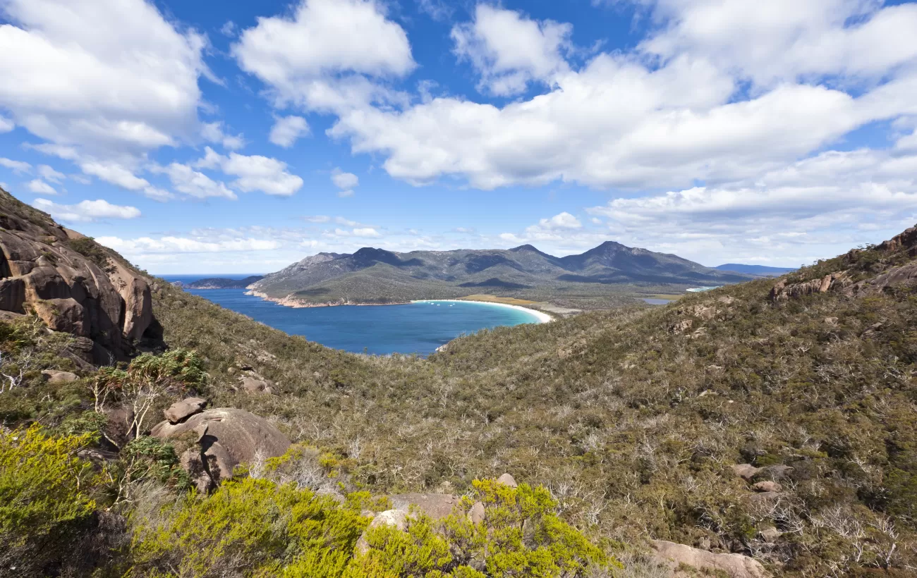
Discover the rugged beauty of Freycinet Peninsula, with pink granite mountains like the Hazards, white sandy beaches, and scenic bays like Wineglass Bay. Guests will have the option of:
HAZARD LOOP
Elevation: 204m – Travel from Wineglass Bay across the Isthmus track, continuing down to Hazards Beach before looping back to Wineglass Bay’s lookout trail.
Walk Details:
› Time: 3.5-4 hours (12 km loop)
› Grade: Level 3 – mixed elevation and rocky areas; steps on the descent to Wineglass Bay
› Gear: Water, sturdy shoes or boots, and a sun hat.
ISTHMUS TRAIL
A relatively flat, well-maintained trail between Hazards Beach and Wineglass Bay, featuring sand, dirt paths, and boardwalks.
Walk Details:
› Time: 30 minutes (2 km round trip)
› Grade: Level 2 – mostly gentle terrain, easy and enjoyable
› Gear: Water, sturdy shoes or boots, and a sun hat.
WINEGLASS BAY LOOKOUT
Elevation: 204m – Climb a well-constructed path through coastal woodlands and granite boulders to reach this famous lookout. A steady, steep ascent includes over 500 steps leading up to the viewpoint.
Walk Details:
› Time: 2-hour round trip (3 km from Wineglass Bay)
› Grade: Level 3 – moderate to steep climb
› Gear: Water, sturdy shoes or boots, and a sun hat.
MARIA ISLAND NATIONAL PARK
Maria Island provides a refuge for Tasmania’s native wildlife, including wombats, kangaroos, and wallabies, and is a prime spot for birdwatching. Guests will have the option of:
BISHOP AND CLERK
Elevation: 620m – Ascend through grasslands, forests, and rocky slopes to reach dolomite columns at the summit. Expect steep sections and a challenging boulder field before the final ascent.
Walk Details:
› Time: 4-5 hours round trip
› Grade: Level 4 – challenging; rough, steep terrain and limited signage, with some exposed cliffs and rock scrambling
› Gear: Raincoat, warm layers, sturdy shoes or boots, and a sun hat; consider thermal pants, gloves, and a beanie.
FOSSIL CLIFFS LOOP
Elevation: 54m – A gentle loop walk from the jetty to Darlington Settlement, with some uneven grass areas, a steep hill climb, and fossil cliffs displaying marine life from 300 million years ago.
Walk Details:
› Time: 2-2.5 hours (4.5 km loop)
› Grade: Level 2 – gentle trails with one steep incline
› Gear: Water, sturdy shoes or boots, and a sun hat.
PAINTED CLIFFS
Elevation: 56m – This coastal loop leads to the scenic painted cliffs near Hopground Beach. Best accessed at low tide for a safer experience on the rock platform.
Walk Details:
› Time: 2-2.5 hours (4 km loop)
› Grade: Level 2 – mostly level trail with gentle inclines; rock platform requires caution
› Gear: Water, sturdy shoes or boots, and a sun hat.


/140x140.webp)


