Central American Weather
Belize Tours | Costa Rica Tours | Guatemala Tours | Nicaragua Tours | Panama Tours
The only thing predictable about South and Central America's weather is its unpredictability. In fact, in some countries (especially those near the Equator), it's not uncommon to experience all four seasons in a single day. In other regions, seasons are dramatically different with hurricanes during part of the year and drought during another. You can check the Weather links for each country for detailed weather information.
In general, Central America has a distinct wet and dry season. Temperatures are relatively similar year round, but rainfall varies considerably from nearly none at all to 12 inches or more in a single month. The wet season runs from June to October and the dry season from mid November to May. Despite these predictable patterns, it's not unheard of to have a sudden flood in the dry season or to have two weeks of gorgeous weather in the middle of the wet season. Most activities and tours are available year round, though some of our Belize vacations are unavailable from July to October because of the increased hurricane risk.
South American Weather
Amazon Tours | Argentina Tours | Bolivia Tours | Chile Tours | Ecuador Tours | Falkland Island Tours | Guyana Tours | Peru Tours | Uruguay Tours
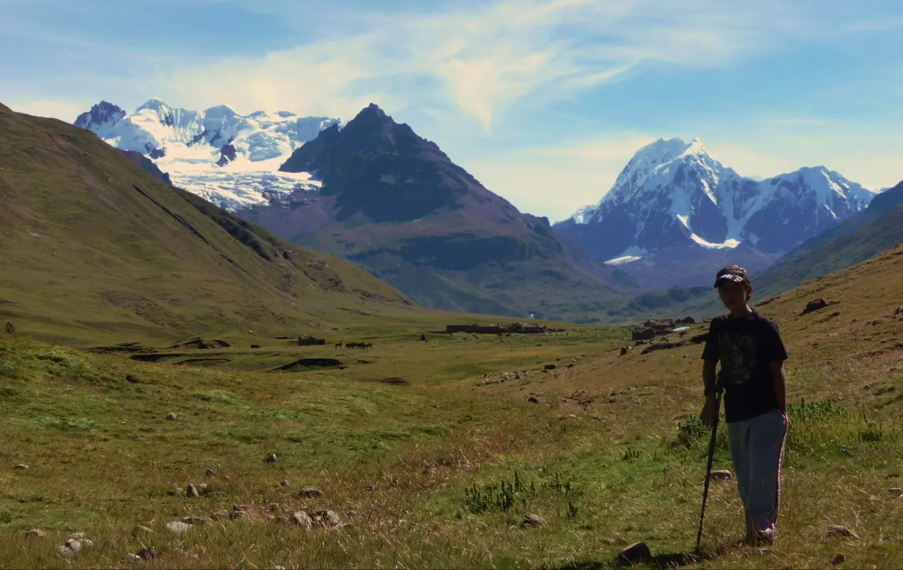
The Andean regions including parts of Ecuador, Peru, and Bolivia also have a distinct wet and dry season, though the months are essentially reversed from Central America. May to November tends to be the driest time of year in these areas and also the coldest. The farther you travel away from the Equator and the higher your elevation, the more dramatic the temperatures changes are. In the highlands, temperatures commonly dip below freezing during the peak of the dry season and climb to 80º F or more during the wet season. You shouldn't feel limited by either the rainfall or temperature changes however. The Andean wet season isn't particularly wet and the dry season sees its share of downpours. In general, shoulder season (spring and fall) often offer the best bet for pleasant weather and smaller crowds, though most areas can be visited year round.
The Amazon region experiences...you guessed it, rain, heat and more rain and heat! The average daytime temperature is 32-35º C (90-95º F), while nights can cool down to 20º C (68º F). The less wet season in the jungle roughly corresponds to the dry season in the Andes.
Chile and Argentina cover such a large range of latitudes and elevations that overall generalizations are not particularly useful, though specific regions have somewhat predictable weather patterns. Patagonia, the southern region of these two countries, commonly has temperatures below freezing during their winter months, May to September. During the summer, daytime temperatures may climb into the 50s or 60s. Be prepared for incessant winds anytime of year, especially summer. In the shoulder season months - November and March - you are likely to find the winds not as strong as they are during the peak of summer.
Antarctica travel is only available from November to March as ice blocks main access routes during the remainder of the year. Temperatures along the most commonly visited region, the Antarctic Peninsula, range from -5-5º C (20-40º F) during the summer months. Antarctica experiences the strongest winds on the planet, and is the world's driest desert with minimum annual rainfall, especially in the interior.
South and Central American Weather
Ecuador
|
Peru
|
Argentina
|
Chile
|
|---|
Bolivia
|
Costa Rica
|
Guatemala
|
Belize
|
|---|
Panama
|
|---|
Average High Temperature (°F)
Average Rainfall (inches)
| |
Jan |
Feb |
Mar |
Apr |
May |
June |
July |
Aug |
Sept |
Oct |
Nov |
Dec |
| Belize City |
Temp |
80 |
80 |
83 |
85 |
87 |
87 |
86 |
86 |
86 |
84 |
82 |
80 |
| |
Rain |
4.5 |
2.6 |
1.9 |
1.7 |
4.0 |
8.6 |
8.1 |
7.0 |
9.5 |
10.0 |
7.0 |
6.7 |
| Buenos Aires |
86 |
83 |
79 |
72 |
66 |
59 |
59 |
62 |
66 |
71 |
77 |
83 |
| |
3.6 |
4.0 |
4.4 |
3.3 |
2.8 |
1.9 |
2.2 |
2.3 |
2.4 |
4.3 |
3.9 |
3.7 |
| Cusco |
65 |
65 |
66 |
67 |
67 |
66 |
66 |
67 |
68 |
69 |
69 |
69 |
| |
6.3 |
5.2 |
4.3 |
1.8 |
0.3 |
0.1 |
0.2 |
0.3 |
0.9 |
1.9 |
3.1 |
4.7 |
| Galapagos |
84 |
86 |
88 |
86 |
82 |
78 |
76 |
74 |
76 |
77 |
78 |
80 |
| |
2.8 |
4.0 |
4.5 |
4.0 |
1.9 |
1.9 |
1.9 |
1.4 |
1.3 |
1.0 |
1.0 |
1.2 |
| Guatemala City |
72 |
75 |
77 |
78 |
78 |
75 |
74 |
74 |
73 |
73 |
72 |
72 |
| |
5.2 |
4.3 |
3.8 |
1.5 |
0.4 |
0.1 |
0.1 |
0.2 |
0.8 |
1.5 |
2 |
3.6 |
| Guayaquil |
88 |
88 |
88 |
90 |
88 |
88 |
85 |
86 |
88 |
86 |
88 |
88 |
| |
8.8 |
11 |
11.3 |
7.1 |
2.1 |
0.7 |
0.1 |
0.0 |
0.1 |
0.1 |
0.1 |
1.2 |
| Juliaca |
56 |
56 |
56 |
56 |
53 |
50 |
49 |
51 |
56 |
58 |
59 |
58 |
| |
5.2 |
4.3 |
3.8 |
1.5 |
0.4 |
0.1 |
0.1 |
0.2 |
0.8 |
1.5 |
2 |
3.6 |
| La Paz |
55 |
56 |
56 |
57 |
57 |
55 |
55 |
56 |
57 |
58 |
59 |
58 |
| |
5.1 |
4.1 |
2.8 |
1.4 |
0.5 |
0.2 |
0.3 |
0.6 |
1.2 |
1.6 |
2.0 |
3.7 |
| Lima |
79 |
80 |
80 |
76 |
72 |
69 |
67 |
66 |
67 |
69 |
72 |
76 |
| |
0 |
0 |
0 |
0 |
0 |
0.1 |
0.2 |
0.1 |
0.1 |
0.1 |
0 |
0 |
| Panama City |
88 |
89 |
89 |
88 |
86 |
86 |
86 |
86 |
86 |
84 |
86 |
86 |
| |
1.2 |
0.6 |
0.6 |
3.0 |
8.0 |
7.9 |
7.3 |
7.6 |
7.6 |
10.3 |
10.0 |
5.3 |
| Puerto Maldonado |
87 |
87 |
87 |
87 |
85 |
84 |
85 |
88 |
89 |
89 |
88 |
88 |
| |
13.6 |
12.8 |
11.9 |
6.1 |
4.2 |
2.3 |
2.2 |
2.5 |
3.9 |
6.5 |
9.3 |
12.1 |
| Punta Arenas |
57 |
57 |
54 |
49 |
44 |
39 |
38 |
41 |
76 |
50 |
53 |
56 |
| |
1.4 |
1.1 |
1.6 |
1.6 |
1.7 |
1.3 |
1.3 |
1.3 |
1.1 |
0.9 |
1.1 |
1.2 |
| Quito |
65 |
66 |
66 |
66 |
66 |
67 |
67 |
67 |
68 |
67 |
67 |
66 |
| |
4.5 |
5.1 |
6.0 |
6.9 |
4.9 |
1.9 |
0.8 |
1.0 |
3.1 |
5.0 |
4.3 |
4.1 |
| San Jose |
75 |
76 |
79 |
79 |
80 |
79 |
77 |
78 |
79 |
77 |
77 |
75 |
| |
0.4 |
0.2 |
0.5 |
1.8 |
8.8 |
10.9 |
8.4 |
9.6 |
12.8 |
12.7 |
5.8 |
1.6 |
| Santiago |
85 |
84 |
80 |
72 |
64 |
58 |
57 |
61 |
65 |
71 |
77 |
82 |
| |
0.0 |
0.1 |
0.2 |
0.5 |
2.3 |
3.1 |
3.0 |
2.1 |
1.1 |
0.5 |
0.2 |
0.2 |
| Ushuaia |
57 |
56 |
54 |
49 |
43 |
40 |
39 |
42 |
46 |
50 |
53 |
56 |
| |
1.5 |
1.8 |
2.1 |
2.2 |
2.1 |
1.9 |
1.4 |
1.8 |
1.6 |
1.4 |
1.4 |
1.7 |
| |
|
|
|
|
|
|
|
|
|
|
|
|


